


LAMANRIAU.COM, PEKANBARU – The Bureau of Meteorology, Climatology and Geophysics stated that the number of hotspots which are indicative of the beginning of forest and land fires in Riau Province jumped to 53 points, on Saturday afternoon.
“The number has increased compared to this morning, there are 35 points,” said the staff of Analysis of BMKG, Pekanbaru Pension, Bibin, Saturday (7/27).
The imaging results of the Terra Aqua satellite at 16.00 WIB showed that there were 53 hotspots in Riau. Most are in Pelalawan, which is 27 points. Then there are also seven spots in Bengkalis, Siak six points, Inhil five points, Inhu two points, and each one point in the Meranti Islands, Rohil, Kampar, Kuansing, and Rohul.
According to Bibin, from that number there are 25 points that have a level of confidence above 70 percent. Most likely it was the Karhutla hotspot. The most locations are in Pelalawan, there are 20 points. Its position in the north of Pekanbaru City.
“There are many in the Langgam and Pangkalan Kuras areas,” he said.
He said the direction of the wind blew from the southwest to the southeast and directed north. Smoke has the potential to reach Pekanbaru depending on the speed of the wind that blows.
“From the direction it can go to Pekanbaru, but it depends on the wind speed. Now, the wind is slow, it is very unlikely (smoke) to Pekanbaru,” he said.
There are two other locations where there are hotspots in Bengkalis, and the rest in Kuansing, Rohul and Inhu one point each.
The Province of Riau is now a Forestry Emergency Preparedness status set by the Governor of Riau from February 19 to October 31, 2019.
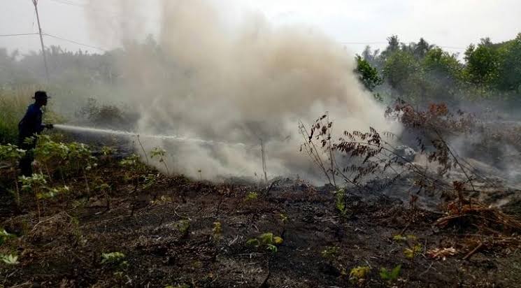
The Riau Forestry Task Force continues to strive to extinguish fires, but dry weather conditions make peatland fires difficult to extinguish.
Blackout efforts are carried out by personnel from land and air. Since the beginning of this week, blackouts have continued to be carried out in Langgam, Pelalawan. On Saturday morning the helicopter was monitored on air from Pekanbaru to drop a water bombing.
Previously, the National Disaster Management Agency (BNPB) stated that the extent of forest and land fires in Riau until mid-July 2019 had reached 27,683.47 hectares. Forest and land fires in Riau are half of the total area of fires in Indonesia, reaching 42,740.42 hectares.
Riau is also listed as the region with the highest number of hotspots during 2019, which is 2,960 points. (ant)


